Moisture from Hurricane Rosa bringing high possibility of flooding to Southern Utah
ST. GEORGE — Southern Utah’s dry spell is expected to be washed away early next week when a hurricane hovering over the Pacific Ocean makes landfall.
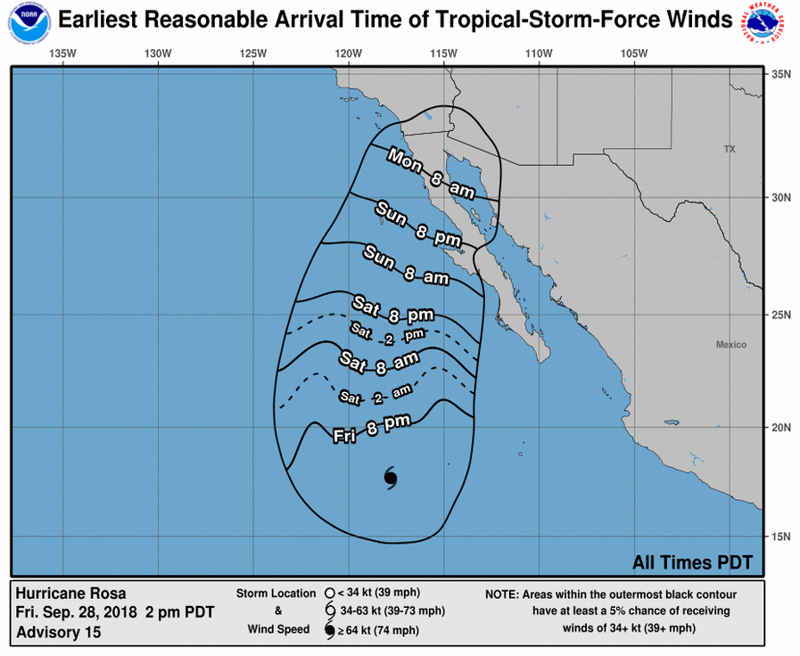
Currently listed as a category 3 hurricane by the National Oceanic and Atmospheric Administration, Hurricane Rosa is forecast to move inland over northern Baja California by Monday. Moisture associated with the storm is thereafter expected to spread northeast through parts of the Southwest U.S.
Southern Utah will see the potential for heavy rain as early as Monday, according to the National Weather Service, with rains becoming stronger and more widespread over the state Tuesday.
The rain brings the possibility of flash flooding, particularly over prone areas such as burn scars, slot canyons, normally dry washes and urban areas with poor drainage.
Statewide, there is the potential for debris flows originating from burn scars and ponding on roadways. Main river stems, such as the Virgin River, will likely experience high water flows.

Regionally, the tropical moisture will also bring heavy rain and flood potential to northern Arizona and southern Nevada, where a flash flood watch is in effect from Monday afternoon through late Tuesday night.
According to the National Weather Service, rainfall rates of 1 to 2 inches per hour could lead to extensive flash flooding in communities and recreation areas in the Arizona Strip and southern Clark County, Nevada, including through the Virgin River Gorge into the Beaver Dam/Littlefield area and Mesquite.
Although the storm system is expected to be strongest Monday and Tuesday, it is forecast to remain over the Southwest for much of the week.
The moisture will also usher in significantly cooler temperatures to Southern Utah, bringing an end to the dry heat that has triggered warnings about critical fire weather this weekend.
Read more: Southern Utah weekend weather: I’ve seen fire and I’ve seen rain…well, not yet
According to The Weather Channel, next week’s highs will be in the 70s in St. George and the 60s in Cedar City.
Email: jwitham@stgnews.com
Twitter: @STGnews
Copyright St. George News, SaintGeorgeUtah.com LLC, 2018, all rights reserved.